 The Littleton Public Works Department manages the city's major drainage ways and floodplains. The city works closely with Mile High Flood District to manage hydrologic and hydraulic studies that redefine floodplain delineations within the city. Major drainageways in the city that have floodplains delineated include:
- Big Dry Creek
- Slaughterhouse Gulch
- Little's Creek
- Lee Gulch
- Rangeview Gulch
- Jackass Gulch
- Dad Clark Gulch
- South Platte River
- Drainageway D
- South Jeffco Drainage South
- and small portions of Dutch Creek, Three-Lakes Tributary, South Jeffco Drainage North, and Coon Creek
What is a "floodplain?"
The floodplain is an area of low-lying ground adjacent to a river or stream, subject to inundation of water during a large rainstorm and flood event. However, sometimes streams and creeks are put into underground pipes during urban development. Then, the floodplain is the amount of water that does not fit in the pipe and flows on the surface, such as in streets. This occurs in a number of locations in Littleton.
The "100-year" flood event is the main floodplain that is shown on flood maps and represents the extents of water that can be expected in such a flood event. The “100-year” event means a flood that has a 1 in 100 chance of occurring (or being exceeded) in ANY YEAR. It is also called the "1% annual chance" event. Similarly, a “10-year” flood means a flood that has a 1 in 10 chance of occurring/exceed in any year. It is important to understand that "100-year" does NOT mean the flood occurs once every 100 years.
Flood history in Littleton
In Littleton, the flood season runs from about mid-April to mid-September. The usual cause of flooding is intense spring or summer thunderstorms causing rapid runoff of storm water. The areas of greatest flood threat are on the numerous tributary streams in Littleton, such as Little's Creek, Slaughterhouse Gulch, and Lee Gulch.
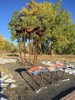
A significant flood occurred along the South Platte River in 1965. South Platte Park provides educational materials about the flood in the Carson Nature Center and also has a flood indicator sculpture.
Flood preparedness
In 2021, the Littleton city council adopted the Arapahoe County Hazard Mitigation Plan 2020-2025(PDF, 16MB) as part of all hazard planning, including floods.
This plan and the action items are collectively reviewed annually by participating communities, including Littleton. The last annual evaluation is summarized in these documents:
Floods are one of several natural disasters that could affect Littleton, as identified in the Arapahoe County Hazard Mitigation Plan (above). Use the National Risk Index for Natural Hazards tool from FEMA to view relative risk for various natural hazards at a county or census tract level.